Welcome to the South Cheltenham Local History Website
Cheltenham became fashionable following the discovery of the natural mineral waters in 1716. In the 19th and early 20th centuries its spas, promenades, parks and avenues, appealed to those seeking healing and relaxation and the town experienced a property boom. The area once known as South Town contained both residential streets and the trades that serviced the more affluent districts; with its abundance of independent shops and businesses, it remains a vibrant community. Click on a coloured area of the map, below left, to read the histories of those traders. And for a more general history of the area use the South Town and Tramroad links on the menu bar, above.
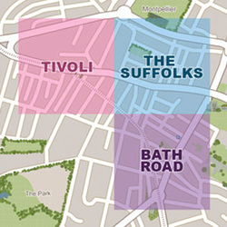 Select a coloured area of the map above
|
Why The Area MattersSouth Cheltenham has a contrasting industrial, commercial and residential heritage, reflecting competing interests in its development in the 19th century. Here the former mansions of the rich rub up against workers cottages, all within just a few streets. And the area possesses many small, privately owned shops and businesses, some having been in the same family for generations.
There are three main shopping areas, Bath Road, the Suffolks and Tivoli, each with its own special character. The variety of cafes, pubs, restaurants and speciality shops makes this is a very popular part of Cheltenham. |
|
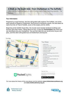
Guided Walks
|
How you can contribute...
The website is being expanded and updated all the time. If you would like to get involved in researching the history of the area, have any local memories, or can supply photographs, we'd love to hear from you via our contact page.
All of the photographs and text are copyright protected. Please see our copyright notice for further details, or get in touch through our contact page.
All of the photographs and text are copyright protected. Please see our copyright notice for further details, or get in touch through our contact page.