South TownIntroduction
In the first half of the 19th century Cheltenham experienced rapid urban growth, soon overflowing into neighbouring parishes and hamlets. In the area to the south, straddling the border with Leckhampton parish, the new streets formed a district briefly known as 'South Town'. That district broadly corresponded to the area encompassed by Montpellier Terrace, Park Place, Bath Road and Shurdington Road. 'South Town' today has a particularly diverse character, with its mix of large elegant houses, shops, cafes, working-class terraces, pubs, churches and small workshops. It is partly the result of vigorous private enterprise, in the form of stone quarrying and its associated trades in Leckhampton, meeting with the high-end property boom driven by speculators in Cheltenham. In addition, the aspirations of the land owners and the practicalities of everyday life had great bearing upon how the area developed. |
Until the first decade of the 19th century this was still open countryside. The fully urban landscape we see today was preceded, in 1810, by the building of a horse-drawn tramroad across the fields, connecting the limestone quarries on Leckhampton Hill with Gloucester Docks. Along the route there were numerous railway sidings leading to mason's yards, and a few lime kilns processing the stone, but the area initially retained a distinctly rural aspect.
Meanwhile the promotion of nearby Cheltenham as a fashionable spa and health resort created feverish property speculation and drove the relentless expansion of the town. There was an influx of wealthy aristocrats, business people, retired military officers and the gentry, alongside their servants, together with tradesmen, music tutors, laundresses, coachmen and labourers. In South Town we can see today how these people of such contrasting means and outlook shaped the area.
Back in 1700 Cheltenham had been a fairly typical small market town, centred on the High Street, serving a rural district. In about 1716 spa water was discovered in the Bayshill area, lighting a slow fuse to the development of the town as a health and holiday resort. The first building over the well was erected in 1738 by Henry Skillicorne but it was not until after the visit of George III in 1788 that Cheltenham began a period of rapid growth, eventually encompassing the surrounding countryside in the 19th and 20th centuries.
The area to the east and west of today's Bath Road straddled the historic boundary between Cheltenham and Leckhampton parishes. Until about 1815 it was almost entirely farmland crossed by paths and lanes, with a few cottages and hamlets, such as at Sandford and Moorend. But in the following 40 years the area was transformed into a fully urban environment as Cheltenham expanded southwards.
A Rural Scene

In John Norden's survey of 1617 the area south of the river Chelt consisted mostly of open fields, which had existed since at least Norman times, including Naunton, Sandford and Westall Fields. Open fields were broad unenclosed stretches of privately owned land divided into smaller areas called 'furlongs'. These, in turn, were subdivided into parallel strips held by different tenants and normally the same crop was grown by each tenant within a furlong. The open fields were 'common', in that when they were not being used to grow crops all of the owners and tenants could pasture their animals on them. There would have been few trees, hedges or ditches, unlike in the modern English countryside, but those that existed would have been recognised landmarks. For example the 'Minnow Ditch' ran through the area that later became the Norwood Triangle.
Several other water-courses crossed the area, some emanating from the spring line at the foot of the Cotswold escarpment. These are now largely culverted and difficult to trace on the ground but the Westall, Nolty, Moorend and Hatherley Brooks continue to flow unseen beneath our feet and feed a number of large ponds in the area.
In 1617 there were few buildings, and very little obvious infrastructure, but there was a farm track from Charlton Park to Alstone, which much later formed the route of Back Montpellier Terrace and Sandford Road. A similar ancient track preceded Suffolk Road but before the 19th century, apart from these and various footpaths, only the route to Bath (now the Old Bath Road) existed.
As early as the 12th century open land in England began to be consolidated into discrete parcels, in a process known as 'enclosure'. This continued through the centuries, extinguishing common rights over the land and allocating parcels or blocks to different owners, in compensation for their loss of the scattered strips in the open fields. The new owners were required to plant hedgerows and lay roads to the new fields created. Moorend, Westall and Gallipot Farms probably resulted from such enclosures.
|
In the late 17th century Edward Wright built a farmhouse called Gallipot Hall, on the north eastern (Cheltenham) side of the former Westal open field, which his son sold in 1694. The buyer, Edward Mitchell, acquired more land, increasing the farm to about 115 acres (47 hectares) and by 1756 it consisted of about 160 acres (65 hectares).
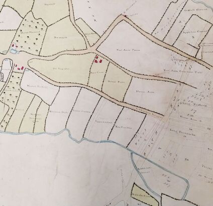
The remnants of the open fields were mostly enclosed in 1788 and by 1809 only fragments remained. The smaller meadows created were distinguished by individual names such as 'Home Acre' and 'New Grotten'. When the New Bath Road was constructed in the 1820s it cut through some of these enclosed fields, including one called 'Kidditch Corner', near to the present day Exmouth Arms. The map on the left showing parts of Westall and Gallipot Farms (marked in red) was produced in 1835, based upon a survey of 1765. Some of the fields have faint lines indicating the old strips in the furlongs of the open fields. Two of the tracks crossing the landscape (marked in pale brown) are today Back Montpellier Terrace and Suffolk Road, whilst the multi-storey Eagle Tower, built in 1968, is located in a former field called 'Red Acre Piece'. |
The parish boundary between Cheltenham and Leckhampton before the creation of South Town partially followed the Westall Brook, which today flows under the Bath Road at the Exmouth Arms. From there it ran close to the line of the present Ashford Road, crossed Park Place just north of the Park estate, westward south of Albany Road and on to converge with the Hatherley Brook, near to the modern day St James primary school.
Cheltenham Expands Southwards
In the early decades of the 19th century Cheltenham was transformed in a burst of property speculation fuelled by a fashion for spas, ready capital and the availability of building land. The scene was set in the south of the town for the residential overspill into the ancient parish of Leckhampton.
In 1756 John Delabere had bought Gallipot Farm and when the open fields in Leckhampton were enclosed about thirty years later he bought more land from the Earl of Essex, becoming the dominant land owner in Westal, Naunton and Sandford. This consolidated land- holding opened the possibility of building development. The Reverend John Delabere inherited the Gallipot and Westal Farm estate on the death of his father John Delabere in 1795.
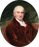 John Howard, 15th Earl of Suffolk, by Henry Bone
In 1801 and again in 1807 Reverend John Delabere sold some of his land to Henry Thompson, the builder of Montpellier, and in 1804 sold Gallipot Hall to John Howard, the 15th Earl of Suffolk. The Earl enlarged and remodelled the house in about 1808 and renamed it Suffolk House. That building was demolished in 1936 and was replaced by the flats in Suffolk Square of the same name. The street that became Suffolk Parade was laid out by Thompson in about 1813 and following his death in 1820 his sons sold individual plots on the east side for building. From as early as 1821 some of the houses in Suffolk Parade included the provision for a street-front shop.
The Earl of Suffolk also died in 1820 and his heirs sold some of his estate to a Cheltenham hotelier named James Fisher, who built Suffolk Square from about 1823 and donated land for the building of St James' church. For a few years before this the houses in Suffolk Parade would have looked out on the cultivated strips in the field called Home Piece, which is now largely occupied by the bowling club.
The Earl of Suffolk also died in 1820 and his heirs sold some of his estate to a Cheltenham hotelier named James Fisher, who built Suffolk Square from about 1823 and donated land for the building of St James' church. For a few years before this the houses in Suffolk Parade would have looked out on the cultivated strips in the field called Home Piece, which is now largely occupied by the bowling club.
The Upper Bath Road Area
The New Bath Road was enabled by an Act of Parliament in 1813 and was constructed through enclosed remnants of the former Westall, Sandford and Naunton common fields. The name 'Westall' was preserved in the Bath Road for many years, for example in the original name of the row of shops which until 2023 incorporated the NatWest Bank. Bath Road was at first known as the New Bath Road, to distinguish it from the Old Bath Road, and it originally ran from Cambray to Birdlip, and then on to Painswick and Bath. The final connection to central Cheltenham was only made in 1854 by demolishing some of the buildings in the High Street.
The New Bath Road was a turnpike or toll road, with side gates to prevent hauliers accessing it without paying fees. In the upper Bath Road, where there are now shops, in the early years the unpaved road divided a field called Long Furcombe, with arable farmland on either side. It must have retained a semi-rural appearance for a while but plots of building land began to be sold at the Cheltenham High Street end of the road from about 1816, or earlier. By 1819 the road had been partially built up as far as the Exmouth Arms, where there was a toll gate, and this building may then have marked the entrance to the town. There were very few buildings nearby and a few years later in 1821, when the Norwood Arms was built, it was described as 'the only house in the area'. It then must have marked the edge of the town, before further development of this Cheltenham suburb occurred along the Shurdington Road.
The side roads off Bath Road, such as Suffolk Street and Exmouth Street, were formed in about 1823 but some houses had by then been built to the south of the Exmouth Arms, as the town continued to expand. Upper Bath Street already existed by 1827 and the following year several tenanted cottages and parcels of building land there were offered for sale. Great Norwood Street followed the line of a spur from the tramroad, removed in 1825. Meanwhile Commercial Street was begun in 1824, and Union Street was described in 1832 as having been newly built.
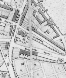 Merrett's Map. 1834
Already in the 1820s there were various traders represented in the street, such as bakers and wheelwrights. One of the earliest of these, in 1829, was Mr W.T. Bown, a baker, mealman, corn chandler, grocer, tea dealer, bacon, cheese and butter factor, whose shop was located near to the Exmouth Arms. But it seems probable that the character of the Bath Road as a predominantly artisan and commercial district was not really settled until the late 1830s.
In 1820 James Robert Scott had commenced the building of his magnificent home Thirlestaine House, at the junction of Bath Road and Thirlestaine Road. When it came up for sale in 1831 it was described as a 'palace' on the 'outskirts' of Cheltenham. In the mid 1820s another fine mansion called The Hermitage was built on the east side of Bath Road, between what are now Hermitage Street and Francis Street, by John Barke Gustavus Ferryman. It had stables, a coach house, outbuildings, a garden and pleasure ground, and an adjoining one acre paddock. By 1842, although still relatively new, The Hermitage had been demolished and replaced with a row of shops called Hermitage Terrace, together with more houses in Hermitage Street and Francis Street.
In 1820 James Robert Scott had commenced the building of his magnificent home Thirlestaine House, at the junction of Bath Road and Thirlestaine Road. When it came up for sale in 1831 it was described as a 'palace' on the 'outskirts' of Cheltenham. In the mid 1820s another fine mansion called The Hermitage was built on the east side of Bath Road, between what are now Hermitage Street and Francis Street, by John Barke Gustavus Ferryman. It had stables, a coach house, outbuildings, a garden and pleasure ground, and an adjoining one acre paddock. By 1842, although still relatively new, The Hermitage had been demolished and replaced with a row of shops called Hermitage Terrace, together with more houses in Hermitage Street and Francis Street.
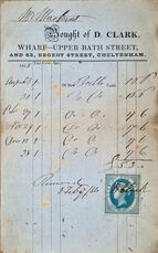 Coal Merchant's receipt, 1854 (Courtesy of Steve Lawrie)
The main central business district was a mile to the north in Cheltenham High Street, too far away to serve the needs of the grand new houses being built in this southern suburb, so local shops became a necessity. The shop premises we have today were variously either purpose-built or converted from residential dwellings as the 19th century progressed. It was common for wealthy patrons to be waited upon by shopkeepers who would come out into the street to serve them without having to leave their carriages (hence the "carriage trade"). Some accounts could remain unpaid for up to a year, creating great difficulty for the traders.
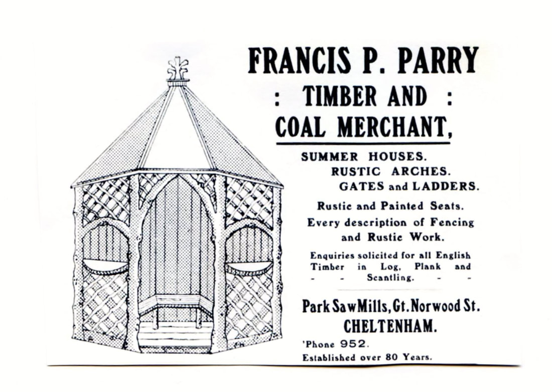
By the mid 1850s the vicinity of upper Bath Road had acquired an almost fully urban aspect, with mostly modest housing, numerous shops, artisan bakeries and brew houses, inns, workshops, stonemason's yards, coal and timber wharfs with their horse stabling, and churches and schools. Trade and commerce were largely driven by the need to service the villas and mansions in The Park and further afield, by supplying goods and services to Cheltenham College and by the flow of materials on the Leckhampton tramroad, which still cut through the streets, contributing to the general air of bustle and activity.
By the mid 1850s the vicinity of upper Bath Road had acquired an almost fully urban aspect, with mostly modest housing, numerous shops, artisan bakeries and brew houses, inns, workshops, stonemason's yards, coal and timber wharfs with their horse stabling, and churches and schools. Trade and commerce were largely driven by the need to service the villas and mansions in The Park and further afield, by supplying goods and services to Cheltenham College and by the flow of materials on the Leckhampton tramroad, which still cut through the streets, contributing to the general air of bustle and activity.
Developments in Leckhampton
Charles Brandon Trye, a senior surgeon at Gloucester Infirmary, inherited the Leckhampton estate from his cousin Henry Norwood in 1797. This included most of the land south of the Westall Brook and some to the north, particularly the fields upon which Great Norwood Street was later built. A shrewd businessman, C.B. Trye recognised that the stone from the Leckhampton quarries would be in demand as Cheltenham developed. In 1810, before there was any significant development to the south of Montpellier Terrace, he built a tramroad link from the quarries, which punched through the fields and hedgerows. It connected with the new Gloucester and Cheltenham Tramroad, terminating at Gloucester docks.
In the early days the main stone depot, called Grotten's Wharf, was on a short tramway spur opposite what is now the Jolly Brewmaster in Painswick Road; another line ran along the future route of Great Norwood Street to a yard in Suffolk Road. The tramroad preceded the later streets laid along its route, including the Leckhampton Road, Norwood Road, Andover Road and Queen's Road. This, together with the pattern of land ownership, and the layout of the fields and streams and tracks, had a powerful effect on the way that South Town evolved. Follow the link here to find out more about the tramroad.
Charles Brandon Trye died in 1811 and his wife Mary ran the estate for a few years until their eldest son, Henry Norwood Trye, came of age. Unfortunately Henry entered into various unprofitable business ventures, leading to large debts. From the early 1820s he was obliged to sell some northern parts of the Leckhampton estate, where it bordered Cheltenham, and many of the properties between Bath Road and Park Place were developed around this time. In 1825 Mr Trye released land to the west of the Bath Road shopping area and by 1835 the solicitor Thomas Billings and architect Samuel Daukes both owned large areas of this part of the estate.
Park Place
Park Place was the first street of housing for the gentry to be developed within the area south of Suffolk Road. The first villas were built in about 1810 and by the time of Merrett's map of 1834 most of the northern stretch of the road was fully built-up with a fine set of smaller villas, forming terraces or separate buildings, broadly harmonious in style. This street had the finest examples in south Cheltenham of the ironwork which graces many Regency and Victorian buildings in the town.
Park Place was the first street of housing for the gentry to be developed within the area south of Suffolk Road. The first villas were built in about 1810 and by the time of Merrett's map of 1834 most of the northern stretch of the road was fully built-up with a fine set of smaller villas, forming terraces or separate buildings, broadly harmonious in style. This street had the finest examples in south Cheltenham of the ironwork which graces many Regency and Victorian buildings in the town.
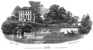 Virginia Water by George Rowe
The southern section of Park Place, on the Leckhampton side of the parish boundary with Cheltenham, fell within The Park estate and was destined to have larger villas. The first to be completed was Virginia Water, designed by Cornelius Blackwell in 1831-33 at the south west corner of Park Place, which had two large lakes in the grounds, fed by the Westall Brook. This house had ten bedrooms and reception rooms 13 feet in height. It was demolished and replaced in about 1960 by the present block of flats, called Park House.
Almost opposite Virginia Water was a fine large villa called Nethermuir, built in about 1837. In May 1932 it was converted into the Hotel Majestic and then, in 1935, greatly enlarged to provide 48 bedrooms. After the Second World War it was renamed the Park Place Hotel but was closed and burnt down in the late 1980s. The site is now occupied by the Park Gate retirement apartments.
Almost opposite Virginia Water was a fine large villa called Nethermuir, built in about 1837. In May 1932 it was converted into the Hotel Majestic and then, in 1935, greatly enlarged to provide 48 bedrooms. After the Second World War it was renamed the Park Place Hotel but was closed and burnt down in the late 1980s. The site is now occupied by the Park Gate retirement apartments.
The Park
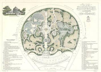
When Henry Norwood Trye was obliged to sell more land in about 1825 the area west of Painswick Road was bought by Thomas Billings (1795-1876). He had the idea to offer housing to the aristocracy and gentry by expanding Cheltenham southwards, in the same way that Joseph Pitt was developing Pittville in the north of the town. Billings' plans for The Park were delayed by a national financial crisis in 1826 but by the early 1830s he had laid out the roads, had built some of the large mansions and villas in the distinctive tear-shaped road pattern, and had great ambitions for the estate.
When Henry Norwood Trye was obliged to sell more land in about 1825 the area west of Painswick Road was bought by Thomas Billings (1795-1876). He had the idea to offer housing to the aristocracy and gentry by expanding Cheltenham southwards, in the same way that Joseph Pitt was developing Pittville in the north of the town. Billings' plans for The Park were delayed by a national financial crisis in 1826 but by the early 1830s he had laid out the roads, had built some of the large mansions and villas in the distinctive tear-shaped road pattern, and had great ambitions for the estate.
|
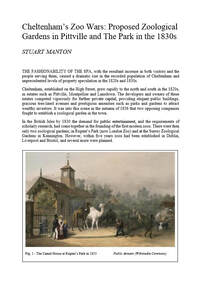
Thomas Billings was convinced that The Park would benefit from a 'unique selling point' and decided that this should be in the form of a zoological garden. The zoo opened in 1838, the foundation stone being laid by Henry Norwood Trye. However it failed to attract sufficient public interest and finally closed in 1844. The site was bought by Samuel Daukes, who sold it on again in July of that year as the possible site for a cemetery. You can read more about this story by clicking on the article 'Cheltenham's Zoo Wars...' by Stuart Manton.
|
Samuel Daukes designed and built many more houses in and around The Park. One of these was Tudor Lodge, which he built for his own use in the Gothic style, neo-classical architecture no longer being in fashion. This house served in the 1850s as the vicarage for St Philip's church and it was demolished in 1969 to make way for an apartment block. The name survives in Tudor Lodge Road and Drive.
A total of 37 villas were constructed around The Park. A number of these survive, while others have been replaced by apartment blocks or by modern pastiche versions of the villas, often with multiple occupancy. On the western side the Gloucestershire College of Art and Technology was built in the 1960s and removed in the early 21st century, to be replaced by modern housing. The Park itself in 1931 became the home of St Mary's teacher training college for women and is now a campus of the University of Gloucestershire. It remains an attractive open space with many fine trees and the lake created for the zoo.
A total of 37 villas were constructed around The Park. A number of these survive, while others have been replaced by apartment blocks or by modern pastiche versions of the villas, often with multiple occupancy. On the western side the Gloucestershire College of Art and Technology was built in the 1960s and removed in the early 21st century, to be replaced by modern housing. The Park itself in 1931 became the home of St Mary's teacher training college for women and is now a campus of the University of Gloucestershire. It remains an attractive open space with many fine trees and the lake created for the zoo.
Gratton Road and Surrounding Streets
Gratton Road, previously called The Grafton Road, was laid out as a complement to the development of the Cheltenham and Gloucester Tramroad. A southward continuation of Great Norwood Street, it sits at the boundary between the artisan settlement nearer to Bath Road and the gentrified area leading to The Park.
These roads remained part of the Leckhampton estate and Henry Norwood Trye, the lord of the manor, developed this area himself. He had the roads laid out and built Brandon House, on the corner of Painswick Road and Grafton Road, for his own use. This house dates from about 1825 and is one of Cheltenham's finest villas, with a classical porch and windows of Egyptian style. Its extensive garden once reached along Painswick Road as far as Trye's Road. When, in the early 20th century, Brandon House became a school, these gardens formed the playing field. Later the garden was sold for building new homes and the house was converted into offices but in about 2017 it was restored as a private home.
Henry Norwood Trye established a discipline to be imposed on purchasers of property in this area, setting out the width of verges, demanding aligned frontages and a homogeneous appearance on the buildings, with facades of 'Roman cement', curbsides of forest stone and equal proportions to the houses. After he fell into financial difficulty the western end of what is now Grafton Road was sold and became part of The Park estate. Its large villas and splendid avenue of trees are due to the ambition of Billings and his successor Samuel Daukes. By contrast, the eastern part of Grafton Road, and the terraces of Gratton Road, have a more modest character, perhaps reflecting the proximity of the tramroad and of the artisan settlement of South Town. Nevertheless, the birch avenue and the harmonious terraced villas of the southern end of Gratton Road are a fine piece of townscape.
Merrett's map of 1834 shows that development on Gratton Road was slow, with only a few houses at the southern end, and two free-standing villas at the junction with Grafton Road. These two villas, facing each other across Gratton Road, were Greville Villas (now Greville Lodge) on the east corner and Greville House on the west corner.
A little to the east of Gratton Road, Norwood Road had a more artisan character, influenced by the tramroad (which line it followed) and the proximity of the shops and commercial premises in the Bath Road. By the mid 19th century the tramroad gradually ceased to be viable. The advent of the mainline steam railway between Cheltenham and Gloucester from about 1840, and later lines into Gloucester docks, captured much of the freight traffic, whilst road transport also improved. By 1861, when the tramroad closed, the line was already a considerable impediment in the streets of South Town and its removal was a relief. Several of the tramroad marshalling areas and warehouses remained however, as coal and timber yards and as small industrial sites.
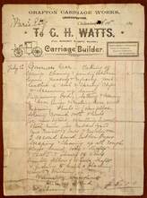 G.H.Watts Invoice (photo Steve Lawrey)
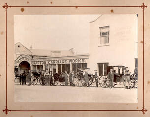
By about 1873 the former weighbridge and loading yard at the corner of Norwood Road and Grafton Road became the Grafton Carriage Works, owned by G.H. Watts. This small company made and sold a variety of horse-drawn carriages, including vans, shooting carts, dog carts and buggies. George Watts, with his wife Louisa and 8 children, lived above the workshop but later in life had a comfortable home called Penwern in the Leckhampton Road. He became a Deacon of Cambray Baptist church and retired and sold the company in 1921, after about 50 years in business.
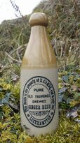
On an opposite corner of the street was the Grafton Brewery. First mentioned in the 1851 census, when the brewer was Francis Martindale, it employed just one man. In the early 1850s the brewery was bought by Ashby Saunders, who expanded the business and bought the adjacent houses at 24 and 26 Gratton Road, where he lived with his wife and two children. By 1881 the brewery advertised ales made of pure malt and hops, with beer at 8d. per gallon. In 1883 a new proprietor, Mr Benjamin Coombe, explained that the brewery had a satisfactory supply of water derived from an underlying sand bed, which was lifted by steam power to a tank at the top of the building. The brewery closed around 1925 and there is little evidence of it today.
On an opposite corner of the street was the Grafton Brewery. First mentioned in the 1851 census, when the brewer was Francis Martindale, it employed just one man. In the early 1850s the brewery was bought by Ashby Saunders, who expanded the business and bought the adjacent houses at 24 and 26 Gratton Road, where he lived with his wife and two children. By 1881 the brewery advertised ales made of pure malt and hops, with beer at 8d. per gallon. In 1883 a new proprietor, Mr Benjamin Coombe, explained that the brewery had a satisfactory supply of water derived from an underlying sand bed, which was lifted by steam power to a tank at the top of the building. The brewery closed around 1925 and there is little evidence of it today.
Shurdington and Painswick Roads
The earlier route south from Cheltenham to Bath followed the Old Bath Road up the Cotswold escarpment to Birdlip and then to Painswick and Bath. Although this must have included some difficult gradients for horse-drawn vehicles, no doubt it avoided water- logged lower terrain. But with the increase in traffic and better road building techniques, in 1819 a Painswick surveyor named Charles Baker was engaged by a group of turnpike trustees to plan a new shorter route to Painswick via Shurdington. This road connected with the New Bath Road at the Norwood Arms and opened in 1822.
Painswick Road was laid out in the 1820s as a spur off the route from Painswick to Cheltenham, effectively bypassing the new Bath road. It also operated as a toll road, or turnpike, before it gained its current residential character. At the northern end it continued into Lypiatt Road and Montpellier Street before reaching the town centre. The western side of Painswick Road, from 'Lower Grafton Street' (now called Ashford Road) southwards, was included in the Park estate, purchased by Henry Billings from the Leckhampton estate in about 1825. Merrett's map of 1834 shows that road frontage, and also the northern side of the Shurdington Road within the Park estate, divided into plots for sizeable villas but none had actually been built by that date. The only buildings on Painswick Road were at the northern end, nearer to Cheltenham, including a large house called the Casino, which was built in 1824. A contemporary engraving shows the Casino standing alone in countryside, with a clear view across the fields to Leckhampton church. The house was demolished in the 1930s and is remembered only by the name 'Casino Place'.
The Merrett map should also have shown Brandon House, at the corner of Painswick Road and Grafton Road (see above).
Tivoli (with thanks to the late Rev. Brian Torode)
Tivoli is part of the ancient tithing of Westal, Naunton and Sandford, purchased by John Delabere in the late 18th century from the Earl of Essex and later sold on to the Earl of Suffolk and to the property developer Henry Thompson. The streets of this district clearly follow the field pattern of the Delabere sale particulars. Until 1834 most of Tivoli was open land with a few imposing houses punctuating the landscape. Hatherley Court was such a property and was occupied by Pearson Thompson, son of Henry Thompson.
At the beginning of the nineteenth century the horse drawn tram road from Leckhampton Hill to the depot on the Gloucester Road passed along Andover Road, through Westal Green and into what is today Queen’s Road. Property developers were permitted to create sidings at their own expense near to their building sites so that stone, gravel and timber could be conveniently unloaded. Such a siding was opened at Westal Green by Pearson Thompson and his associates, who were accused in 1825 of having encroached on the Green, narrowing the public highway. They were also accused of destroying the surface of the Green by converting it into a railroad for their own private use. This may be related to Thompson’s proposed Lansdown development which he began in 1826, or to the building of his own home, Hatherley Court.
In 1834 the Cheltenham Looker-On newspaper reported that in Andover Road a row of 15 houses had been built alongside the tram road. It said that they would ideally suit people of 'middle rank' and enable them to carry on their trades by the establishment of shops. Davies’ Guide to Cheltenham of 1843 says "new buildings rose with a rapidity perfectly surprising between 1831 and 1841 in Tivoli.”
Churches
In the 1820s and 1830s the overspill of residential Cheltenham into Leckhampton parish resulted in new places of Christian worship being built, including St James', St Philip's (now St Philip and St James'), St Stephen's, Bethesda Methodist church and the Providence Baptist Chapel.
In the 1820s and 1830s the overspill of residential Cheltenham into Leckhampton parish resulted in new places of Christian worship being built, including St James', St Philip's (now St Philip and St James'), St Stephen's, Bethesda Methodist church and the Providence Baptist Chapel.
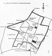 St James' Parish
The earliest of these, St James' church in Suffolk Square, was built in 1825-30 as a 'proprietary church' where subscriptions to private pews largely paid for the building. The site was donated by James Fisher, the developer of Suffolk Square and the local architect was Edward Jenkins, who was later replaced by J.B. Papworth, the London architect of the Montpellier estate. The parish (outlined in black - click on the map, left) was sandwiched between neighbouring parishes and bordered to the south by Leckhampton, making it geographically rather small. Nevertheless the church was successful and by 1840 the congregation was described as “the most affluent and fashionable of any in Cheltenham”.
By the late 1830s such was the rapid growth of South Town that St James was no longer deemed adequate and it was decided to build St Philip's, further to the south. This later became St Philips and St James'. In 1965 it was proposed that the parishes of St James' and St Philips and St James' should unite and the vicar of the latter was appointed priest of St James. Although St James' was given a reprieve, it was was de-consecrated in 1974 and the two parishes combined.
By the late 1830s such was the rapid growth of South Town that St James was no longer deemed adequate and it was decided to build St Philip's, further to the south. This later became St Philips and St James'. In 1965 it was proposed that the parishes of St James' and St Philips and St James' should unite and the vicar of the latter was appointed priest of St James. Although St James' was given a reprieve, it was was de-consecrated in 1974 and the two parishes combined.
In the late 1830s the parish of Leckhampton launched an appeal to raise funds to complete St Philip's church, then being built for the new community around the Upper Bath Road, described as "poor bretheren", consisting mostly of mechanics and labourers. The main sponsors of the project were the Reverend Charles Brandon Trye, Vicar of St Peter's at Leckhampton, and his brother Henry Norwood Trye, who donated land for the project.
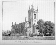 St Philip's, 1863 (courtesy of Neela Mann)
The first building on the site was designed by Edward Shellard as a rather pretty small Regency Gothic church, with a tower at the eastern end. The foundation stone was laid on 24 April 1838 by Henry Norwood Trye but when the money ran out additional funds had to be raised by converting 180 of the sittings into private pews. St Philip's, was finally consecrated in 1840, with the Rev. J.E. Riddle as priest-in-charge. This was a daughter church of St Peter's, Leckhampton, although the Religious Census of 1851 shows that it had a much larger congregation than its parent church.
In 1864 St Philip's underwent some improvements; the benches were replaced by pine pews and sold off at an auction held in the yard next to the Norwood Arms and gas lighting was installed, making evening services possible.
In 1864 St Philip's underwent some improvements; the benches were replaced by pine pews and sold off at an auction held in the yard next to the Norwood Arms and gas lighting was installed, making evening services possible.
 Edward Wilson
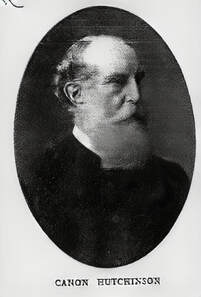
The new building was consecrated in 1882 under Canon Hutchinson and was estimated to have cost £9,700. The planned spire was never installed due to problems with the foundations and the now familiar copper-covered saddle-back roof was added in 1903. The original crypt of St Philip's church was retained, still containing about 60 graves of mostly wealthy parishioners. Some of the stained glass and many memorials from St Philip's were installed in the new building.
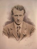
Amongst notable members of St Philip and St James' congregation were Dr Edward Wilson, who died with Captain Scott in the Antarctic in 1912, and Miss Dorothea Beale, first Principal of Cheltenham Ladies College. Several of the boarding houses of the Ladies College also attended.
Amongst notable members of St Philip and St James' congregation were Dr Edward Wilson, who died with Captain Scott in the Antarctic in 1912, and Miss Dorothea Beale, first Principal of Cheltenham Ladies College. Several of the boarding houses of the Ladies College also attended.
St Philip's church founded a boy's school in the early 1840s and built a new schoolroom adjacent to The Norwood Arms in 1862, with an infant's school added in 1866. These schools served the rapidly expanding district south of the Bath Road, around Upper Norwood Street, and later the Naunton Park area. As the 20th century dawned the buildings proved to be inadequate to the need and the St Philip's schools were closed by 1908, only to be re-opened temporarily during the First World War, when the new Naunton Park council school became a hospital for wounded troops. The buildings continued to be used for church and public meetings for many years and in the 1970s became a private dance school. Part of the accommodation now also forms offices for an accountancy business.
St Stephen's was built by the architect John Middleton to serve the district of Tivoli. This was originally conceived in 1868 as a chapel of ease by Canon Fenn, the vicar of Christchurch, the parish in which Tivoli belonged, to satisfy a perceived shortfall in church accommodation in this working district. The earliest part (the chancel) was begun in 1873 but only held 250 people when it was completed a year later. By 1878 it was necessary to enlarge the church with a nave and side aisles and the extended building was consecrated in 1883, providing space for 650 people. St Stephen's attempted to provide for all classes of people in the area and in 1888 opened a church hall in Albany Road, as well as a parish infant's school in 1889. The school was funded by the parish and by voluntary fees but was obliged to close in 1920 as it was unable to compete with the free education offered by state schools.
Bethesda Chapel, in Great Norwood Street, was preceded by an outdoor meeting place established by the Methodists in 1828. A cottage in St Philips Street and a disused blacksmiths shop in Upper Bath Street were then used for worship, before in 1830 a small chapel was built in Great Norwood Street. This proved to be inadequate and a larger church was built on the present site, starting in 1845, whilst the smaller building was demolished and replaced by the old St James' primary school. The 1845 church was enlarged in 1867. The Wesley Chapel in St George's street founded a day school in 1844 and, being short of suitable accommodation, this transferred to a new building behind the Bethesda Chapel in 1851. This school closed in 1907, when the Naunton Park school opened, but was re-used during both world wars and the building accommodated many meetings and societies over the years.
Providence Baptist Chapel may have been founded as early as 1835 and the Religious Census on 1851 mentions a Baptist congregation meeting in a building called "Providence Room" in Bath Terrace, which was used exclusively as a place of worship. It had free sittings for 100 and an average of 50 worshippers attending morning service. The present chapel was built in about 1870 by John Smith, a local Butcher, at a cost of £802. Smith purchased the land from Charles Liddell in 1871 for £450. The land and church was then left to trustees upon John’s death in 1888. The church is still open today and is located on Naunton Parade, off Exmouth Street.
Providence Baptist Chapel may have been founded as early as 1835 and the Religious Census on 1851 mentions a Baptist congregation meeting in a building called "Providence Room" in Bath Terrace, which was used exclusively as a place of worship. It had free sittings for 100 and an average of 50 worshippers attending morning service. The present chapel was built in about 1870 by John Smith, a local Butcher, at a cost of £802. Smith purchased the land from Charles Liddell in 1871 for £450. The land and church was then left to trustees upon John’s death in 1888. The church is still open today and is located on Naunton Parade, off Exmouth Street.
St James Church School
 St James's Church School, 1850
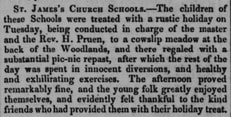
St James' church supported a school sometime before 1844 and the 1855-57 Old Town Survey map shows it to have been at the corner of Upper Bath Street and Great Norwood Street. This corresponds to the southern part of the still-existing school buildings (although long since converted into residential accommodation). The Cheltenham Chronicle and Parish Register of 23 May 1850 carried a charming account of an outing for the children to Woodlands, located just off The Park. In July 1853 the school in Great Norwood Street was struck by lightning and some damage was caused. One of the earliest masters was Mr Pearce, whose son fell into trouble when, in November 1854, he discharged a pistol aimed at another boy, resulting in him being hospitalised.
 Cheltenham Looker-On, December 1861
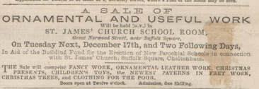
St James Church held special Sunday services in 1857, when sermons were preached to raise funds for the repair of the building but the resignation of the minister, Rev F.D. Gilby, in 1858 contributed to the general neglect of the school. In December 1861 another fundraising event was advertised regarding the sale of ornamental work and Christmas gifts in support of erecting new school buildings. Meanwhile the work of the school carried on and the children continued to enjoy outings. In August 1864 their field trip was to Witcombe Roman Villa in two brakes from the Regent Mews and two horse drawn buses provided by the Queens Hotel.
St James' School (taken from '120 Years of St James School, Cheltenham' - 1985)
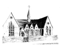
St James' church finally opened a new school building in the heart of our community, in Great Norwood Street, on 2nd October 1865. This was built partly upon the site of the previous school, which it may have incorporated. It received a government grant but the church paid for the upkeep of the buildings, furnishings, bibles, hymn books and prizes and gifts. The school was arranged in three parts; boys, girls and infants. There were about 50 boys and an unknown number of girls. Pupils also paid between one penny and fourpence per week, depending upon in which class they were.
The first headmaster was Mr J. Adams and teaching was initially confined to reading, writing and arithmetic but in 1867 geography was added to the curriculum. The vicar would frequently attend the school to test pupils on scripture knowledge. The outbreak of the Franco-Prussian war in 1870 aroused an interest in current affairs and history.
The first headmaster was Mr J. Adams and teaching was initially confined to reading, writing and arithmetic but in 1867 geography was added to the curriculum. The vicar would frequently attend the school to test pupils on scripture knowledge. The outbreak of the Franco-Prussian war in 1870 aroused an interest in current affairs and history.
Unfortunately Mr Adams suffered from poor health and, as a result, in about 1875 the school was forced to close for several weeks. During this period young student teachers struggled to keep the school open when possible. When Mr Adams left the school in 1882 the church congregation, school managers, teachers and pupils presented him with a substantial sum of £45 as a measure of the high regard in which they held him.
Compulsory school attendance was introduced by the Education Act of 1870 but this raised some problems of overcrowding and some parents refused to send their children to school on economic grounds, relying upon them to work and earn money. The Act led to other schools being opened, including St Philip's beside the Norwood Arms (now a school of dancing and accountancy office) and, later, St Stephen's.
Compulsory school attendance was introduced by the Education Act of 1870 but this raised some problems of overcrowding and some parents refused to send their children to school on economic grounds, relying upon them to work and earn money. The Act led to other schools being opened, including St Philip's beside the Norwood Arms (now a school of dancing and accountancy office) and, later, St Stephen's.
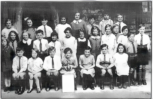
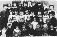 A Class at St James, 1906
At St James' the parishioners and school managers tried to relieve the worst effects of poverty and malnutrition but the late 19th century was a bleak time for the area. Houses and the school were overcrowded, resulting in illnesses such as scarlet fever, typhoid fever, diphtheria, measles and whooping cough. In the spring of 1896 there was a serious smallpox epidemic and on at least one occasion the school was closed for health reasons. Sometimes dirty children were sent home to be washed and they rarely reappeared the same day. Around 1900 the vicar's wife, Mrs Nash, arranged school visits with buns, sweets and apples for the children, together with a ladies sewing group to make them clothes. Boots were given to the boys and in 1911 a boot repair kit was provided, so that the boys could mend their own boots. In 1910 dinners were provided twice a week for the poorest children.
In Edwardian times the girl's school achieved a high standard for handwriting and composition. Sewing was practised and by 1904 even the 6 year old infant girls were making their own pinafores. In April 1904 the first visit was made to Alstone Swimming Baths (which was located in the present Waitrose petrol station!). The children had to walk there and paid a penny admission. In preparation for this the girls had to make their own bathing costumes.
In 1901 the children were taught how to complete the national census forms so that they, in turn, could show their parents.
The 1891 Education Act abolished the need for teachers to collect pennies each week from the children and extended the summer holiday to a month. They were still encouraged to bring their pennies to deposit in the Penny Bank, which was set up in all schools in 1892 as a savings scheme. Further government action in 1902 made local authorities responsible for funding and managing schools.
The First World War brought great changes. In May 1915 Naunton Park schools were taken over as a hospital for the troops and the pupils from there were accommodated at St James', working on a shift system of weekly alternating mornings and afternoons. This continued until 1917, when the school was able to return to a full day's work. On 13th October 1915 the staff and older boys attended the funeral of Private Joseph S. King, 16 years old, of the 10th Battalion, Gloucestershire Regiment, who died from wounds received in action. He had left the school in June 1913 and was the first of many to be mourned there. One of the teachers, Mr Parker, was called up for military service in 1917.
There was great rejoicing at the declaration of the end of the war, on 11 November 1918, but hard times prevailed. There was no coal for the school boiler and the Spanish flu epidemic was running wild throughout the country, causing the school to be closed for three weeks. After the war swimming classes recommenced and football was played at Naunton Park. In 1925 St James won the Schools Football Shield.
There was great rejoicing at the declaration of the end of the war, on 11 November 1918, but hard times prevailed. There was no coal for the school boiler and the Spanish flu epidemic was running wild throughout the country, causing the school to be closed for three weeks. After the war swimming classes recommenced and football was played at Naunton Park. In 1925 St James won the Schools Football Shield.
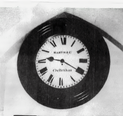 The School Clock
In 1926 the school was reorganised and alterations were made to the building to create St James Junior Mixed school, with pupils over 11 years old being transferred to the new St Lukes and St James Senior School. The Headmistress was Miss Marion Weaver, better known to her friends as 'Minnie', who came from Warden Hill Farm. Two improvements were that in 1930 gas lighting was replaced with electric light and in 1936 Miss Weaver bought a wireless set for the children to listen to suitable broadcasts.
The juniors continued to walk to Alstone Baths for swimming each week during the summer term and in 1936 a sports day was held in the grounds of Brandon House. The school retained its association with St James church, attending some services and participating in the church fete. The vicar took the school morning assembly on Thursdays. Academically the school did well, passing pupils to the Grammar Schools and the Technical High School each year.
The juniors continued to walk to Alstone Baths for swimming each week during the summer term and in 1936 a sports day was held in the grounds of Brandon House. The school retained its association with St James church, attending some services and participating in the church fete. The vicar took the school morning assembly on Thursdays. Academically the school did well, passing pupils to the Grammar Schools and the Technical High School each year.
During the Great Depression of the 1930s Miss Weaver provided the children with cups of warm milk and biscuits for a halfpenny per day. The children were also involved in fund raising activities in support of the hospitals and the elderly of the parish. Films were shown at the Daffodil Picture House and the children went on expeditions to Leckhampton Hill and visited Gloucester Cathedral. In 1929 the school ran a major trip to Bristol Zoo. Local shopkeepers also contributed generously to seaside outings to Burnham on Sea and Weston super Mare.
In 1938 the children were required to carry gas masks with them in anticipation of the Second World War, which began on 3rd September 1939. The school day was altered to allow children to get home before dark, as there was a complete black-out with no street lamps or lights from the houses. Air raid shelters were dug in the playgrounds and when the air raid sirens sounded the children took their gas masks and went down into them. The shelters were without lights or toilets and the floors were often wet. On one occasion pupils watched as a barrage balloon came down in flames and on another two aeroplanes collided in mid-air and the wreckage fell into the Shurdington Road. In December 1940 Cheltenham suffered its first major air raid, which killed several people and destroyed many buildings in this area, such as at 20 Suffolk Road. When the war ended in Europe, in May 1945, there were V.E. Day celebrations and a welcome holiday. Gradually the school returned to peacetime conditions, although food and clothes rationing continued, becoming even more strict after the war and not ending until 1954.
After the war there was a 'baby boom' and most schools became crowded. St James' school had to expand but the site was limited, so classroom accommodation encroached onto the playground. In 1949 new cloakroom and toilet blocks were built, further reducing the open space and some activities were relocated to the nearby Bethesda church hall. In 1976 part of the Bath Terrace car park was leased as additional playground space. The school roll had risen from about 50 pupils in 1865 to 318 in 1972 and it is difficult to imagine how they all fitted into quite a small site. Apart from the overcrowding, the school suffered from poor heating from the day it opened and this was not resolved until 1977.
In the 1950s the school began a programme of visits further afield to places such as London, Cornwall and the Isle of Wight. From the mid 1970s these trips became more adventurous still, to include France, Spain, Portugal, Greece and Italy. Music and sports continued to be an important feature of the curriculum, particularly swimming, at which the school excelled. From 1971 swimming lessons were held at the new Pittville Leisure Centre, a great improvement on the old Alstone Baths!
Finally, in 1985 St James' school was provided with a much-needed new building in The Park. These new premises could accommodate up to 420 children, from 4-11 years old, with greatly improved facilities, including well equipped classrooms, a large playing field, playgrounds and a food technology area. The school was mindful of its history and tradition and continued to value a sense of 'family' which no doubt had existed since its foundation.
The former school premises in Great Norwood Street were soon converted into residential units and the playground reverted to a public car park for the shoppers in Bath Road. The school had given vitality to the area and, with the churches, shops, pubs, cinema and social clubs had contributed to a sense of neighbourhood. An era that had lasted for 120 years was at an end.
